Charts & Harbour
Charts & Harbour Information
The following is a list of charts recommended for ships visiting designated harbours in the Falkland Islands. It is not exhaustive and visitors to other parts of the Islands are recommended to consult the British Admiralty Chart Atlas for any further requirements. A limited range of charts and flags are available from Byron Marine Ltd, H Jones Road, Stanley
Tel: 22245 or email info@byronmarine.co.fk
British Admiralty Chart No. - Title
2505 Approaches to the Falkland Islands
2512 The Falkland Islands
2536 Port William to Choiseul Sound
2547 Port Salvador to Port William
1614 Stanley Harbour and Approaches
2550 Plans in East Falkland Island
A useful book for yachts cruising the islands is “Falkland Islands Shores” by Ewen Southby-Tailyour. The notes in this book were taken by the author during a 13-month survey of the Falkland Islands in 1978-79.
Another useful book is “Brazil and Beyond” by Annie Hill. Travel with the authors on a voyage in Badger along the Brazilian coast and then on to the Falkland Islands, including useful sketch charts of the out-of-the-way ports they visited


Designated Ports and Declared Harbours
Stanley, Port William & Berkeley Sound.
Yachts are required to make Stanley their first port of call. Arrival and departure reports should be made as detailed under Harbour Safety - All Vessels, Port William and Stanley Harbour.
- On arrival, if a berth at one of the jetties has not been arranged in advance or communication cannot be established with either “FISHOPS” or Customs and Immigration, yachts should anchor in the proximity of the public jetty and fly a “Q” flag to indicate customs clearance is required.
- The wreck of the sailing ship “Charles Cooper” has been dismantled down to the low water mark. However, her underwater structure remains. Two unlit Green Wreck marking Buoys have been placed in positions:
51º 41.434´ S057º 51.338´ W
51º 41.442´ S057º 51.291´ W
(Falklands 1943 Datum)
Reporting on Arrival or Departure
The Reporting Line is a line joining the positions 51º 31’S 57º 44’W (Volunteer Point) and 51º 41’S 57º 43’W (Cape Pembroke). This line forms the outer limit of Berkeley Sound and Port William. All vessels entering or leaving Port William should report their “Reporting Line” crossing time. This information should be passed as the vessel enters or leaves, and not retrospectively. Any vessel wishing to enter Stanley Harbour should give her entry time at the Reporting Line and her estimated time at the Narrows.
Jetties & Moorings
East Jetty: Situated on the south shore of Stanley Harbour and belongs to Falkland Islands Company Ltd. It has a 45 metre berthing face with approximately 3.7 metres of water at its head. (contact +500 27630, email: agents@fic.co.fk for further information)
Public Jetty & Pontoons: Used only for landing passengers from launches and other small craft. Yachts may use these facilities to obtain customs clearance & for short stays, but only when not required for Cruise Ship Tenders. There is no mooring or access permitted to the north face of the Public Jetty.
FIPASS (Falkland Interim Port and Storage System): Situated to the east of the Narrows on the south shore of Stanley Harbour. This facility consists of seven permanently moored barges providing 300 metres of berthing face and a Ro-Ro berth. The depth of water varies from 6.5 - 7.2 metres according to berth. Yachts often use the east side of FIPASS.
Noble Frontier: A temporary Dock Facility is situated to the east of FIPASS to support offshore exploration - not for use by yachts.
Government Jetty: This structure has been removed, as it was unsafe.
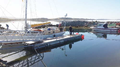
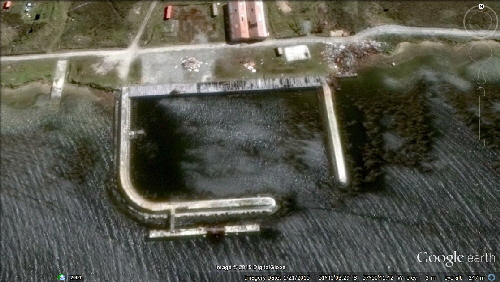
Camber dock: This small marina is on the north side of Stanley Harbour. It is currently under renovation. Contact Fortuna Ltd tel (+500) 22616 or email: admin@fortuna.co.fk
Harbour Authorities
The Marine Officer, Fisheries Department, PO Box 598, Stanley, Falkland Islands.
Office Hours: 0800 - 1630 (Seven days per Week)
Telephone: (500) 27260 & 27266 Fax: (500) 27265
E-mail: fishops@fisheries.gov.fk
Radio
Harbour Authorities - Call "FISHOPS" or "STANLEY PORT CONTROL" on VHF Ch 16 or 10 (24 hours) & HF - 4066.1 Khz (office hours only)
Out of office hours, the VHF watch is maintained by Sure South Atlantic Ltd, who will take all routine reports and in an emergency will immediately alert Harbour Staff. Use the same callsigns "FISHOPS" or "STANLEY PORT CONTROL". In an emergency the Duty Officer can also be contacted via “Stanley Police” on VHF Ch 16.
Harbour Dues
Harbour dues for Yachts is £67.00 (as at May 2015)
AIDS TO NAVIGATION WITHIN FALKLAND ISLANDS WATERS
PORPOISE POINT
- Fl. 10s.
- POSITION 52° 20' 23" S 059° 18' 21" W
FOX POINT
- Fl(2) 10s.
- POSITION 51°55' 19" S 058°23' 53" W
STANLEY HARBOUR ENTRY LIGHTS
- FRONT LIGHT. 2 F.R. 7M INSIDE A RED DIAMOND
- POSITION 51° 41.83’ S 057° 49.9’ W
- REAR LIGHT. 2 F.R. 7M INSIDE A RED DIAMOND
- POSITION 51° 41.9’ S 057° 49.92’ W.
LIGHTS LINE UP ON BEARING OF 185.7°
FIPASS NW CORNER
- 2F. G. Vert
- POSITION 51°41.5’ S 057° 49.23’ W
FIPASS NE CORNER - RO-RO RAMP.
- 2F. G. Vert
- POSITION 51°41.5' S 057°48.93’ W
NAVY POINT
- Fl. R. 6s. 2M
- POSITION 51°40.93’ S 057°49.67' W
ENGINEER POINT
- Fl. G. 6s. 2M.
- POSITION 51°40.92' S 057°49.35' W
BLANCO BAY
- Fl. G. W. R. 2s. 6M
- ARCS OF VIS. G.088° - 270° W. 083° - 088° R.083° - 270°
- POSITION 51°40.1' S 057° 50.67’ W
STANLEY HARBOUR EXIT LEADING MARKS
- RED TRIANGLES ON WHITE POSTS
- POSITION FRONT 51°39.73' S 057°49.33' W
- REAR 50m IN DIRECTION 004.73° FROM FRONT.
CAPE PEMBROKE LIGHTHOUSE
- DAYMARK. BLACK AND WHITE HORIZONTAL STRIPED TOWER 21M
- LIGHT (DISPLAYED FROM FIBREGLASS LIGHT STRUCTURE 35 METRES EAST OF LIGHTHOUSE)
- Gp.Fl(3) 20s 10M
- POSITION 51°40.9' S 057°43' W.
MENGEARY POINT
- Fl(2) 7s 10M
- POSITION 51°38.67' S 057°43.58 W
STRIKE-OFF POINT
- Fl. R. 6s. 2M
- POSITION 51°35.3' S 057°58.3' W
LONG ISLAND
- Fl. 5s 10M
- POSITION 51°33.7' S 058° 02.2' W
VOLUNTEER POINT
- Fl(4) 20s 10M
- POSITION 51° 30.8' S 057° 44.2' W
-
Page last updated October 2015


Camber Dock
Maiden Haven
Maiden Haven
Canache
Aerial view of the Camber